 700+ trench maps from the collection held at The National Archives • Unique searchable index to trench names, hyperlinked to map(s) • Significant places of interest also hyperlinked • Historical and cartographical commentary • Edited by Dr Peter Chasseaud • Full technical support available • Large scale 1:10,000 • Zoom in for detailed analysis • All maps fully printable • Microsoft Vista ,XP and Windows 7 (32 and 64 bit) compatible • Covers the whole length of the British sector of the Western Front • Robust and easy to use interface • The new benchmark in mapping the Front • Bristling with ‘can’t-get-elsewhere’ features • Invaluable resource for tour guides http://www.britishtrenchmaps.comI
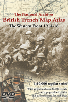
n the eight years that have elapsed since the release of our groundbreaking first Trench Map CD-ROM computer technology has taken a huge stride forwards and we are now able to show in excess of 700 maps on this exceptional DVD. In addition to the maps, we have taken the opportunity to include many years of painstaking research by the world’s leading military cartographer, Dr Peter Chasseaud, whose index to trench names and significant places of interest make this DVD a unique and vital core historical resource. Dr Chasseaud’s commentary for each and every one of the 700+ maps further distances this DVD from both its predecessor and the offerings from other sources that have followed the innovative products available from the Naval & Military Press. It goes without saying that a product from the Naval & Military Press has both a robust and easy to use interface for searching, manipulating and printing the maps, as well as the technical support offered by a large professional company. The National Archives trench map collection is acknowledged as the world’s finest and most complete source of mapping of the Great War. Price + v.a.t. (£29) (v.a.t. is applicable to all U.K. & European
Descubre más desde Sociología crítica
Suscríbete y recibe las últimas entradas en tu correo electrónico.


Posted on 2013/03/31
0